Something I Built: Navver
May 31, 2020
How it started
About a year ago, I started developing a navigation app called Navver that included live weather radar. I was driving back and forth between Pittsburgh, PA and Rochester, NY, and I’d always encounter crappy weather. This was in the winter, and weather between Rochester and Erie, PA is always really bad (that lake-effect snow, man). I remember it was some time in January and I was on my way to Pittsburgh when I hit some really crappy weather. I hadn’t anticipated any bad weather — this seemed to pop out of nowhere (or I was just negligent and didn’t check the forecast well enough) — but sure enough I drove right into a massive blizzard. I remember I couldn’t even see 20 feet in front of me at one point in Buffalo. I remember thinking to myself, “damn, it would’ve been great to see this coming while I was driving towards it so I could take action, or at least know when I would make it through it”, and that’s how Navver was born.
The stack
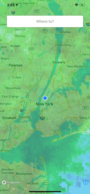
Navver is currently only for iOS and is written with Swift. It’s truly a really basic app. You can see how simple the first screen of the app is — a map with weather overlayed onto it, and a little search bar for writing in where you’re navigating to. I wanted to model it sort of like Google Maps, because I think that UI is very simple and efficient.
|
- | -
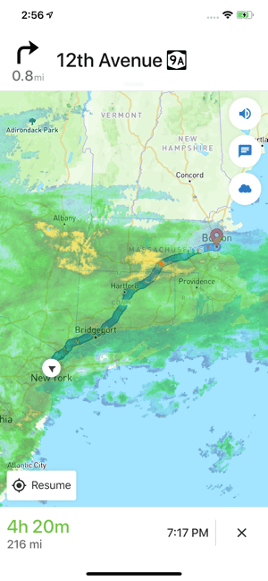
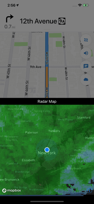
For the maps, I use this service called MapBox. They provide an SDK that gives me the main map, the navigation elements, as well as the geocoder (the thing that turns an address you provide into GPS coordinates). Although as you probably would expect, weather is not included in their services. I have made modifications to the SDK that allow me to overlay the weather data in the navigation screen. You can also see that little cloud button on the side there. That’s something I added to their UI to allow me to create the functionality for a little pop-up radar map.
Now I know what you’re probably thinking: Dan, where do you get the weather data from? Great question. Apparently, nearly no one provides this data (especially not as tiles to overlay on a map like this), but the great people at Iowa State University have an API to do so (and it’s free). Without this service they created, my app wouldn’t exist. I do monitor how many users I have so that I can take action if I think I’m going to stress their services.
Product Hunt
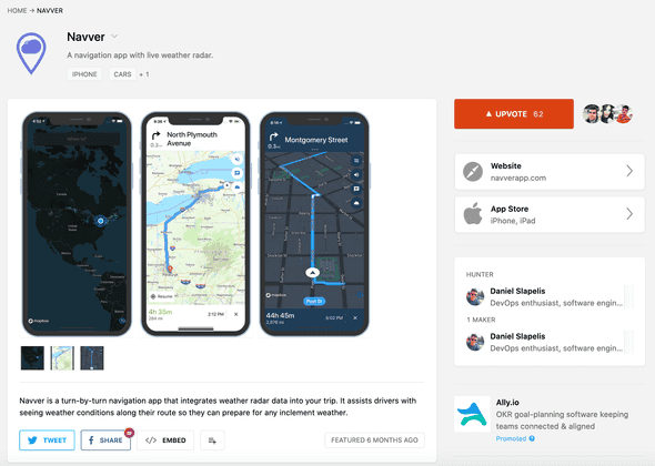
I launched my app on Product Hunt sometime in December 2019. I made it to the number 5 app for the whole day, and I was very happy with that result. I didn’t expect such positive feedback. Although, I haven’t pushed any updates for the application since then, I do have plans for the application. I think it would be useful to provide alerts regarding upcoming weather conditions n miles along your route. I started development on that feature, but I ran into some issues with making changes to the MapBox UI for this feature. I guess it’s something I just need to work harder on when I get the motivation to do so :)
Anyways…
If you made it this far, thanks for reading. In case you want to take a peek at Navver it’s available for download here. One day, when I’m not working on another one of my projects and I feel really motivated I’ll make some updates.


